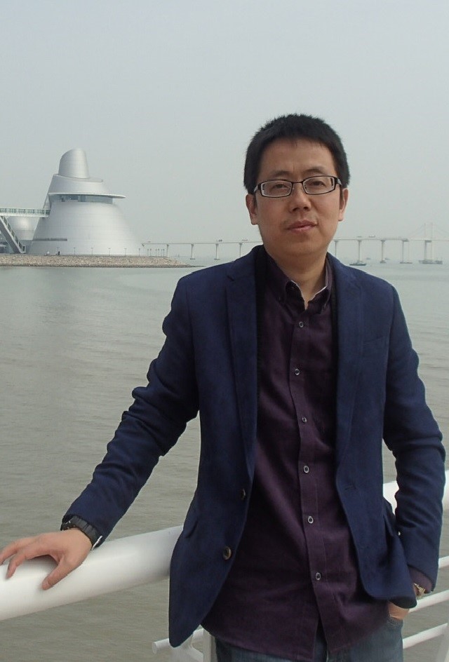
Individual Resume:
Gong Yun, a male, Associate professor, PhD, graduated from Chang 'an University majoring in Geodesy and Surveying Engineering in 2012 with a PhD degree in engineering. After graduation, he mainly engaged in teaching and research work in the fields of geodesy, engineering survey and 3S technology integration and application. He has presided over and participated in 3 national projects, 6 provincial and ministerial projects, and more than 30 cooperative scientific research projects. He has won the Science and Technology Award of Shaanxi Province, 2 Science and Technology Progress Awards of Shaanxi Province in surveying and mapping, and has been authorized 4 national invention patents and 6 utility model patents. In recent years, he has published more than 20 papers in domestic and foreign journals, 8 of which were included in SCI and EI, and won a natural science Excellent Academic Paper Award of Shaanxi Province. He has guided college students to participate in the National College Students' Innovation and Entrepreneurship training program for many times, guided college students to participate in the National College Students' Surveying and Mapping Skills Competition and won awards, and was awarded the title of excellent instructor in the National College Students' Surveying and Mapping Skills Competition.
Email address: 598628883@qq.com
Field of Investigation:
Research on the mechanism of mine measurement and mining damage, real-time underground space positioning and map construction integrating inertial navigation technology; three-dimensional real scene modeling of laser point cloud and inclined photography.
Opening Courses:
Undergraduate courses: Geodey, Case Analysis of Surveying and Mapping Engineering, Discipline Advanced Lecture
Graduate courses: Theory and Methods of deformation Monitoring, Digital Mine
Study and Work Experience:
2007.9- -2012.12 Doctor of Engineering degree from Chang'an University;
2017.8- -2018.2 Visit to Aalborg University, Denmark;
2003.9- -now Full-time teacher of Xi'an University of Science and Technology;
Representative Academic Achievements:
1. Research on the interpolation method of spatial data of spherical coordinates, Surveying and mapping Science, 2019;
2. Research on the horizontal deformation characteristics of the current crust in the arc-land collision zone on the southeast edge of Eurasia, Journal of Wuhan University (Information Science edition), 2019;
3. A shearer positioning and positioning method with additional external azimuth element constraints, invention patent, 2020;
4. A surface deformation continuous monitoring method based on GNSS, invention patent, 2017;
5. Deformation and stability detection method based on burg gravity anomaly, invention patent, 2017;
Major Scientific Research Projects:
1. Construction of integrated university physics and professional courses and textbook system based on project-based learning under the background of new engineering, Provincial Department of Education, 2020;
2. Construction and practice of course quality evaluation mechanism based on the core concept of Engineering Education Professional certification, Xi'an University of Science and Technology, 2020;
3. Xi 'an University of Science and Technology (MOOCs) Curriculum Construction Program, Xi' an University of Science and Technology, 2019;
4. "flipped Classroom" Teaching Reform Pilot Project of Xi 'an University of Science and Technology, Xi' an University of Science and Technology, 2018;
5.2018 Xi 'an University of Science and Technology Textbook Construction Project, Xi' an University of Science and Technology, 2018;
6. Teaching Design and Implementation of complex Engineering Problems in Engineering Education Professional Certification- -Take Surveying and mapping Engineering as an example, Xi'an University of Science and Technology, 2017;
7. Monitoring of East Asia Drought and its impact on terrestrial ecosystem change and the water cycle in the context of climate change- -Collaborative utilization of satellite observation and reanalysis data, National Natural Science Foundation of China, 2017;
8. Research on disaster mechanism of coal mining surface deformation in loess covered area in western China, surface project of National Natural Science Foundation of China, 2017;
9. Simulation Research on Ecological Service Space Flow- -Taking the Soil Conservation Service in the Jinghe River Basin as an example, the General Project of the National Natural Science Foundation of China, 2020;
10. Research on the 3 D detection method of the discontinuous interface of the crustal medium density based on the multiscale decomposition of gravity abnormality, Shaanxi Provincial Department of Education, 2020;
Honors and Awards:
1. Shaanxi Provincial Science and Technology Award, third prize, Shaanxi Provincial People's Government, 2019;
2. Level Instructor of the fifth University Surveying and Mapping Skills Competition, Special prize, Chinese Society of Surveying and Mapping Geographic Information, 2018;
3. Team Instructor of the fifth University Surveying and Mapping Skills Competition, first prize, Chinese Society of Surveying and Mapping Geographic Information, 2018;
4. Excellent Instructor Award of the fifth University Surveying and Mapping Skills Competition, Chinese Society of Surveying and Mapping Geographic Information, 2018;
5. Converse surveying instructor of the 5th University Surveying and Mapping Skills Competition, third prize, China Society of Surveying and Mapping Geographic Information, 2014;
6. University-level Teaching Achievement Award, second prize, Xi'an University of Science and Technology, 2017;
7. Shaanxi Provincial Surveying and Mapping Technology Progress Award, first prize, Shaanxi Institute of Surveying and Mapping Geographic Information, 2017;
8. Shaanxi Provincial Surveying and Mapping Technology Progress Award, second prize, Shaanxi Society of Surveying and Mapping Geographic Information, 2014;
9. Shaanxi Province 12th Natural Science Excellent Academic Paper, second prize, Shaanxi Provincial People's Government, 2013;