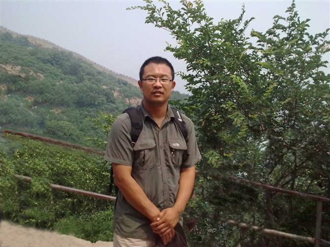
个人简介:
岳辉,男,讲师,博士,硕士生导师。现主持陕西省自然科学基础研究计划1项,企业委托科技项目1项;发表论文50余篇;出版专著1部,参编专著2部;获中国煤炭工业协会科学技术奖一等奖1项,陕西高等学校科学技术奖二等奖1项,三等奖1项。
研究领域:
环境与资源遥感、遥感地学信息提取及生态环境遥感监测与评估
开授课程:
《遥感原理与应用》、《环境监测与评价案例分析》
学习及工作经历:
2009.09—2013.01 中国矿业大学(北京)环境科学 工学博士
2013.03—至今 西安科技大学
代表性学术成果:
1. Comprehensive Assessment of the Ecosystem in Yellow River Basin Based on Pattern-Quality-Service Model. Environmental Modeling & Assessment, 2024.
2. The construction and migration of a multi-source Integrated drought index based on machine learning. Water Resources Management, 2023.
3. Comparative assessment of drought monitoring indices susceptibility using geospatial techniques. Environmental Science and Pollution Research, 2021.
4. Water Balance and Influence Mechanism Analysis: A case study of Hongjiannao Lake, China. Environmental Monitoring and Assessment, 2021.
5. Geospatial Quantitative Analysis of the Aral Sea Shoreline Changes using RS and GIS Techniques. Earth Science Informatics, 2021.
6. Soil moisture assessment through the SSMMI and GSSIM algorithm based on SPOT, WorldView-2, and Sentinel-2 images in the Daliuta Coal Mining Area, China. Environmental Monitoring and Assessment, 2020.
7. A New Accuracy Evaluation Method for Water Body Extraction. International Journal of Remote Sensing, 2020.
8. Eco-Environmental Quality Assessment in China’s 35 Major Cities Based on Remote Sensing Ecological Index. IEEE Access, 2019.
9. Method for Delineating Open Water Bodies Based on the Deeply Clear Waterbody Delineation Index. Journal of Applied Remote Sensing, 2019.
10. Variations in the lake area, water level and water volume of Hongjiannao Lake during 1986-2018 based on Landsat and ASTER GDEM data. Environmental Monitoring and Assessment, 2019.
主要科研项目:
1. 陕西省自然科学基础研究计划, 2023.(主持)
2. 企业合作项目, 2023.(主持)
3. 国家重点研发计划, 2022.(参与)
4. 国家能源集团2030重大项目先导项目, 2021.(参与)
5. 自然资源部矿山地质灾害成灾机理与防控重点实验室开放基金, 2020.(主持)
团队公众号:
联系方式:
E-mail:13720559861@163.com yuehui@xust.edu.cn